I just love travelling especially the adventures places. Most of my vacations are spent as adventurous trips. These trips help me in getting closer to the mother nature in a better way and knowing more about the Earth’s history and geography.
Google Maps has always served as a great companion during my trips and now with the panoramic imagery of the Grand Canyon I will get more. Google Maps has released the comprehensive Grand Canyon imagery, which is one of the world’s most remote and breathtaking natural wonders.
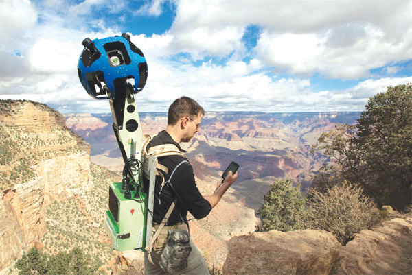
These beautiful and interactive images covering more than 75 miles of surrounding roads are brought by the first ever Street View Trekker. The expedition makes the map of the area even more accurate, comprehensive and easier to use than ever before.
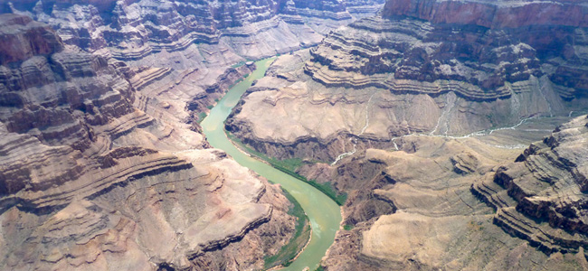
When I saw it, I was virtually hiking in the steep inclines of the South Kaibab Trail. It was a beautiful experience walking down the narrow trails and paths of the Grand Canyon, gazing at the mighty Colorado River, hiking down the Bright Angel Trail and exploring scenic overlooks in full 360 degrees.
A click of mouse took me to the Meteor Crater, which would otherwise take a couple of hours drive from South Kaibab Trail. I really appreciates Google team’s hard work for this imagery collection. Putting on the Android-operated 18 kg backpacks that carry the 15-lens camera system with a wound on foot and muscle cramps along the rocky terrain in temperature swings is not at all an easy job.
All this hard work brought 9,500 panoramas of this natural masterpiece, available on Google Maps. We can now explore the Grand Canyon National Park without waiting for warmer weather. A great effort, I am thankful to Google.


